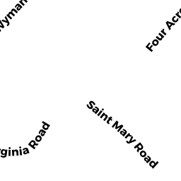
20 ST MARY RD
Owner Information
MITRA ABHISHEK
20 ST MARY RD
BURLINGTON, MA 01803


Property Details
20 ST MARY RD is classified as a Single Family Residential (Cape).
The primary structure on this property was built in 1956. There are 1344ft2 of built area within this property. There is 1344ft2 of residential/living space within this property. This property is listed as having 6 rooms.
20 ST MARY RD is valued at 487800. The land is valued at 295100 and the structures are valued at 189300. There is an additional valuation of 3400 on this property.
This property is in Zone RO. Confirm with local Zoning Board authorities to ensure there are no overlays or other easements on this property.
The most recent deed for 20 ST MARY RD is recorded at the local registrar in Book 75114, Page 14. 20 ST MARY RD was last sold on 2020-07-14 for 475000.
Assessment data from fiscal year 2022.
Flood Data
According to the FEMA National Flood Hazard Layer, this property does not appear to be in a flood zone. It may also be in an area not yet reviewed. Nonetheless, confirm this information prior to taking any action.
To view the flood hazards around this property, create a FEMA "Firmette" Map of the area around 20 ST MARY RD.
Broadband Internet Providers
| Provider | Type | Bandwidth (mbps) | |
|---|---|---|---|
| Verizon New England Inc. | Fiber | 940 | 880 |
| VSAT Systems, LLC. | Satellite | 2 | 1 |
| HughesNet | Satellite | 25 | 3 |
| GCI Communication Corp. | Satellite | 0 | 0 |
| Comcast | Cable | 1000 | 35 |
| Verizon New England Inc. | DSL | 5 | 0 |
| Viasat Inc | Satellite | 100 | 3 |
| Crown Castle Fiber | Fiber | 0 | 0 |
| RCN | Cable | 25 | 4 |
| RCN | Cable | 500 | 20 |
| RCN | Cable | 1000 | 20 |
| T-Mobile | Fixed Wireless | 25 | 3 |
Broadband service provider data from December 2020.
Adjacent Properties
- 22 ST MARY RD
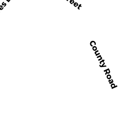
Single Family Residential owned by BUCHER CHRISTOPHER - 0 COUNTY RD
Undevelopable Residential Land owned by LARSON ELMER V JR - 25 COUNTY RD
Single Family Residential owned by LARSON JON - 18 ST MARY RD
Housing, Other (Charitable Org.) owned by NEXUS INC - 1 CLIFFORD RD
Single Family Residential owned by LUONG VINH CHAU